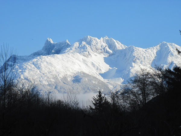
Thunder Mountain (2664 metres or 8740 feet) is an impressive mass of rock - not that we have a shortage of impressive mountains in the Bella Coola Valley, but Thunder Mountain is on it's own. It is located on the east side of Noosgulch River about 10 km up the Noosgulch valley (52°33'10.86"N, 126°22'13.19"W ). There are few places you can catch a view of it now that you can't drive the Noosgulch Forest Service Road (damage from floods), but up in the Rainbow Mountains when you get high enough and look west it is pretty prominent. The only really good look you can get of it from down in the Bella Coola Valley is from the bridge over the Bella Coola River on Highway 20 about 35 km east of the townsite of Bella Coola.
This photo was one I took from the bridge a couple of weeks ago and it doesn't really do it justice, because it's so massive. The back side of the mountain (east side) which you can't see from Bella Coola is really impressive with it's
glacier (Tzeetsaytsul Glacier) coming off adjacent Tzeetsaytsul Peak and massive rock faces. The back side also has a pecular brown or rose coloured small lake, that derives it's colour from the pulverized rock in the glacial melt. I've hiked behind it and you can hear the "Thunder" when you are up there which is the glacier moving. The first climbing ascent was in 1965 by the Whitmores of California.
Grizzly


Great information! I used to see it every clear day on my way home, but I never knew its name. I'd love to go up and hear the glacier!
ReplyDeletewow, totally awesome that you can hear the glacier. Cool name!
ReplyDelete